Searching for the objects on a map within an area looks to be a fairly straightforward task nowadays, but it could still be challenging especially when it comes to handing it within the context of your language and framework. In our case, we are usingDjango and PostgreSQL that have fantastic tools for using geographic types and do querying using GeoDjango and PostGIS.
Feature description
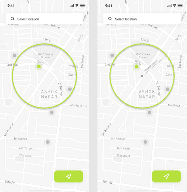
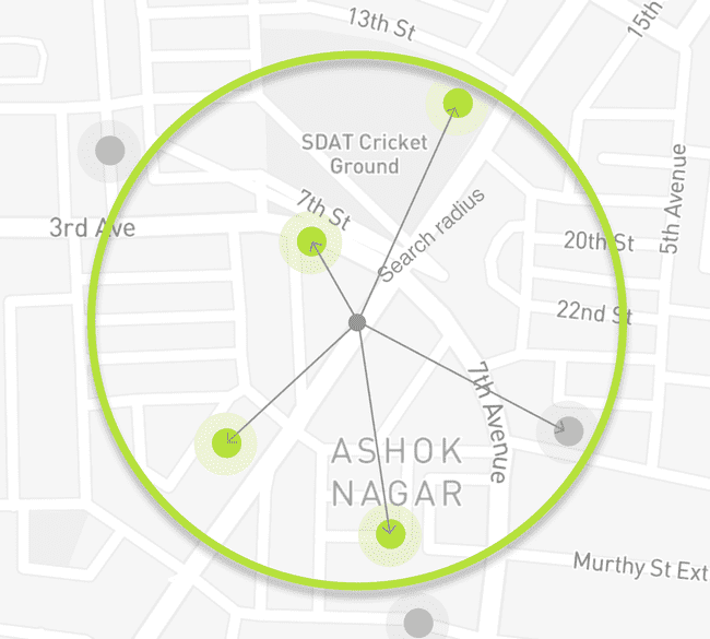
Users should be able to search for the real estate objects (or other points of interest) within the given radius or the location.
The search radius has constrains from 100 meters up to 30 kilometers with the default value set to 10 kilometers. Coordinates of the center could be stored in Mercator projection to have seamless integration with Map/Tiles/GeoCoding providers.
PostGIS functions and capabilities
With PostGIS there two commonly used scenarios that could be well suited for this. With the first approach, we could make
sure that the distance between two geometries isn't bigger than a certain radius and then return objects matching the
criteria. ST_DWithin function could be used for which has the following synopsis.
boolean ST_DWithin(
    geography gg1,
    geography gg2,
    double precision distance_meters,
    boolean use_spheroid = true);
gg1 is the center of our search and the gg2 will be the coordinate of the object
we are matching.
The second solution is based on the calculation of the intersection of two geometries using ST_Intersects.
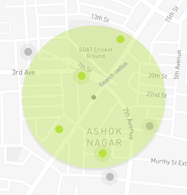
Buffer could be built around our search location with the given radius and then we could get only the objects which are within the intersection with our buffered geometry.
geography ST_Buffer(
    geography gg1,
    float radius_of_buffer,
    integer num_seg_quarter_circle);
boolean ST_Intersects( geography gg1 , geography gg2 );ST_Intersects works fast and make use of indexes where ST_Buffer will buffer every geometry before intersecting which will be rather slower comparing to ST_DWithin.
In our case, there were other places where buffered geometry was used therefore this way was selected. Let's go into implementing it with Django.
Basic Django implementation
The framework already supports plenty of the geographic database functions which could be found here including for example
Distance, Centroid, Intersection, and many others. But looks like that ST_Buffer support isn't there yet.
We start with defining a simplified model to store our search criteria as requested by the feature.
# models.py
from django.contrib.gis.db import models
from django.contrib.gis.db.models import PointField
from django.core.validators import (
    MinValueValidator,
    MaxValueValidator,
)


class SearchCriteria(models.Model):
    geo_location = PointField(
        verbose_name='Location coordinates'
    )
    distance = models.PositiveIntegerField(
        verbose_name='Search radius (in meters)',
        default=20000,
        validators=[
            MinValueValidator(100),
            MaxValueValidator(30000),
        ],
    )
As was mentioned before our application will be using the buffer feature in other places, so it would be reasonable to create a manager for annotating queryset with the buffer value. Note as we are operating with metric units for the radius we would have to cast our geometries into geography types.
# managers.py
from django.contrib.gis.db.models import (
    F,
    PointField,
    PolygonField,
)
from django.contrib.gis.db.models.functions import GeoFunc

class BufferFunc(GeoFunc):
    """Define custom database function based on PostGIS ST_Buffer function"""
    function = 'ST_Buffer'

class SearchCriteriaManager(Manager):

    def with_buffer(self) -> QuerySet:
        """
        The resulting queryset will be annotated with `buff` property representing
        polygon object.
        """
        return self.annotate(
            buff=ExpressionWrapper(
                BufferFunc(
                    # Cast value to geography type to ensure
                    # correct metrics distance.
                    # It is used to build a correct buffer,
                    # otherwise the value of the radius will be set in the
                    # units of the current projection system
                    Cast(
                        'geo_location',
                        PointField(geography=True)
                    ),
                    F('distance')
                ),
                output_field=PolygonField()
            )
        )
Add SearchCriteriaManager as a default manager for the SearchCriteria model.
# models.py
...

from core.managers import SearchCriteriaManager


class SearchCriteria(models.Model):
    geo_location = PointField(
        verbose_name='Location coordinates'
    )
    distance = models.PositiveIntegerField(
        verbose_name='Search radius (in meters)',
        default=20000,
        validators=[
            MinValueValidator(100),
            MaxValueValidator(30000),
        ],
    )
    objects = SearchCriteriaManager()
Register the model in the admin
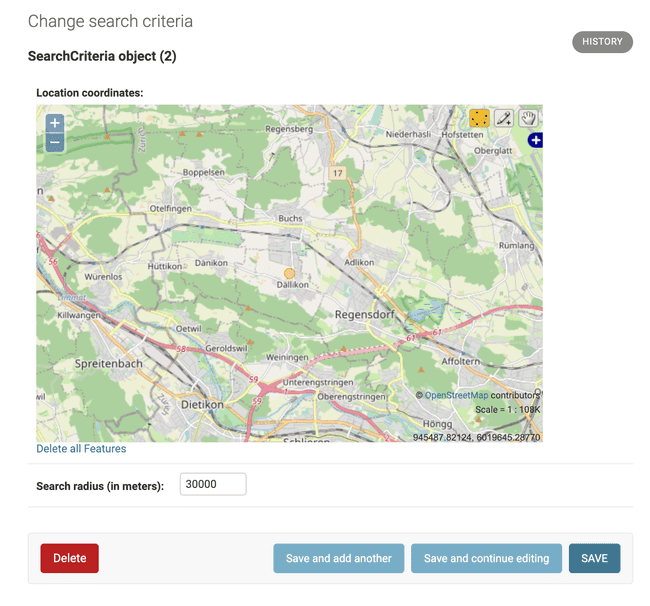
To quickly add new objects we will register our model in admin which gives us a nice interface for managing our objects.
OSMGeoAdmin class allows us to load OSM (OpenStreetMap) tiles and goes with other settings like default latitude and longitude, etc.
# admin.py
from django.contrib import admin

from django.contrib.gis.admin import OSMGeoAdmin

from core.models import SearchCriteria


class SearchCriteriaAdmin(OSMGeoAdmin):
    list_display = (
        '__str__',
        'distance',
    )


admin.site.register(SearchCriteria, SearchCriteriaAdmin)
Testing the solution
After adding few test objects we can make sure that with_buffer method extends our objects with an expected geometry.
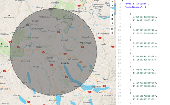
buff property has a Polygon type that matches our expectations. To further prove it we can take the GeoJSON value of the geometry and visualize it using services like GeoJSON.io.
>>> SearchCriteria.objects.with_buffer().last().buff
<Polygon object at 0x10ed795e8>

>>> SearchCriteria.objects.with_buffer().last().buff.geojson
'{ "type": "Polygon", "coordinates": [ [ [ 8.835401282918115, 47.444211668394992 ], [ 8.827927172679484, 47.391537382069345 ],
[ 8.805492519705593, 47.340861557111154 ], [ 8.768996911528763, 47.294123357969781 ], [ 8.719867885154301, 47.253106475893162 ],
[ 8.660002412369668, 47.219372480662862 ], [ 8.591692772164897, 47.194203022350919 ], [ 8.517539800403968, 47.178552775612232 ],
[ 8.440356622258259, 47.173014615346119 ], [ 8.363066011300527, 47.177798095286839 ], [ 8.288594519470969, 47.192721877651124 ],
[ 8.219766512885965, 47.217220336529465 ], [ 8.159201245047289, 47.250364132384533 ], [ 8.109216102392239, 47.290894131167789 ],
[ 8.071739153762552, 47.337267620966976 ], [ 8.048234098293234, 47.387715365251132 ], [ 8.03964059757484, 47.440307631225217 ],
[ 8.046332753399465, 47.493026955403671 ], [ 8.068098107757621, 47.543845072370708 ], [ 8.10413896150482, 47.590801158312111 ],
[ 8.153097015125601, 47.632078354099583 ], [ 8.213101339569546, 47.666075461067329 ], [ 8.281838531044214, 47.691470771504065 ],
[ 8.356642669140996, 47.707275223512298 ], [ 8.434601489265372, 47.712872462428187 ], [ 8.512674119697316, 47.70804393881015 ],
[ 8.587814939016164, 47.692977849195685 ], [ 8.657097675803973, 47.668261487787362 ], [ 8.717833853260867, 47.634857371217294 ],
[ 8.767680079196403, 47.594064266521123 ], [ 8.804729447682634, 47.547464939838463 ], [ 8.827583361042922, 47.496863006014706 ],
[ 8.835401282918115, 47.444211668394992 ] ] ] }'
To finish our testing we can create an additional model holding our points of interest which are real estate objects with their locations.
# models.py
class POITypeChoices(models.TextChoices):
    HOUSE = 'house', 'House'
    APARTMENT = 'apartment', 'Apartment'


class POI(models.Model):
    geo_location = PointField(
        verbose_name='POI location'
    )
    poi_type = models.CharField(
        'POI type',
        max_length=100,
        choices=POITypeChoices.choices,
        default=POITypeChoices.APARTMENT
    )

    def __str__(self):
        return f'<POI {self.id}, {self.poi_type}>'
Querying of the POI objects for the given SearchCriteria could be done like following.
>>> # check POI objects we have in DB
>>> POI.objects.all()
<QuerySet [<POI: <POI 1, apartment>>, <POI: <POI 2, apartment>>]>

>>> # get the buffer
>>> buffer = SearchCriteria.objects.with_buffer().last().buff

>>> # filter only POI objects within the intersection of the buffer and geometry
>>> POI.objects.filter(geo_location__intersects=buffer)
<QuerySet [<POI: <POI 1, apartment>>]>
Having annotated buff value comes handier when answering a question if there are any search criteria for the given POI
>>> poi = POI.objects.get(id=1)
>>> SearchCriteria.objects.with_buffer().filter(buff__intersects=poi.geo_location)
<QuerySet [<SearchCriteria: SearchCriteria object (2)>]>
Footnotes
The described approach has obvious performance penalties and in the next article, we will go through measuring its speed and optimizing it using database indexes and ST_DWithin function. Bye:)
